July 2003
Airplanes, biplanes, smoke trails: skywriting has been around for decades.
In 1995, shortly after I bought my first GPS timing receiver (a Motorola Oncore VP), with a roof mounted antenna and a passenger seat covered with batteries, inverters, a Magellan DGPS beacon receiver, the Oncore, a laptop, and a mess of wires, I captured a NMEA log of a round-trip from home to work.
A couple of Excel scatter charts later - plotting position, plotting elevation, plotting velocity - I was amazed to see roads, turns, lane changes, and stoplights come alive like I had never seen before. I thought at the time it would be cool to "write" large words on the surface earth by picking routes carefully around the city or state(s) while logging 1 Hz NMEA track data; the GPS equivalent of skywriting -- geowriting. That was 8 years ago.
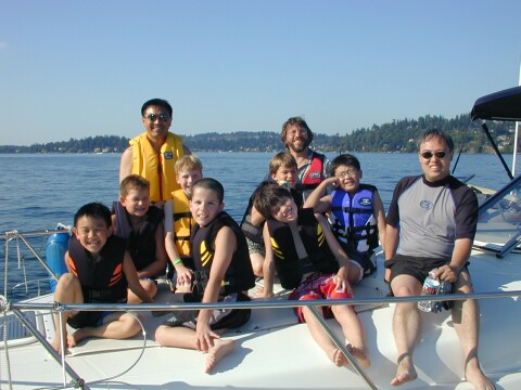
Yesterday, for my son's tenth birthday, three Dads and seven kids went on a boat trip in Lake Washington (between Seattle and Bellevue). In this case, the old VP Oncore stayed home and we used something more modern: Victor brought his GPS enabled Pocket PC and recorded a couple of hours of NMEA data onto a CF card. The kids went tubing so there are lots of curves and loops in the plot. During the afternoon I thought it would be cool to write Nicholas's name on the lake. Having never done this before, in fact, having only recently learned how to drive a boat, and with no real-time navigation equipment onboard, I geowrote by landmark and feel or by watching our wake, dragging kids on a tube behind us the whole time.
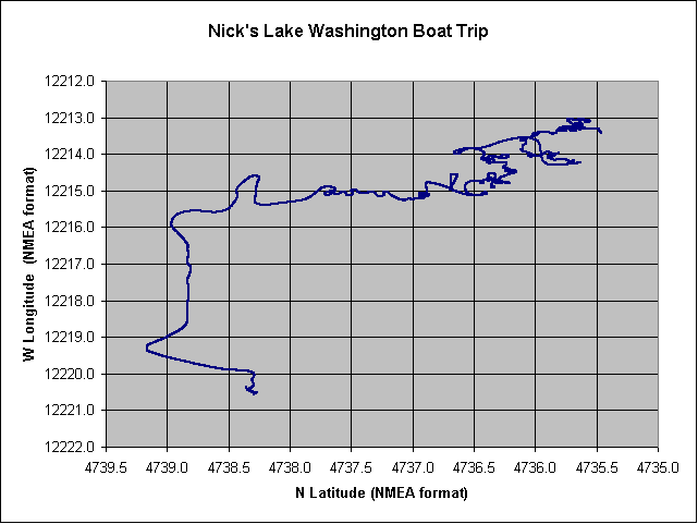
The NMEA log contained 10289 lines (just under 3 hours). First, here's a raw lat/lon plot of the entire trip (North is left, East is up):
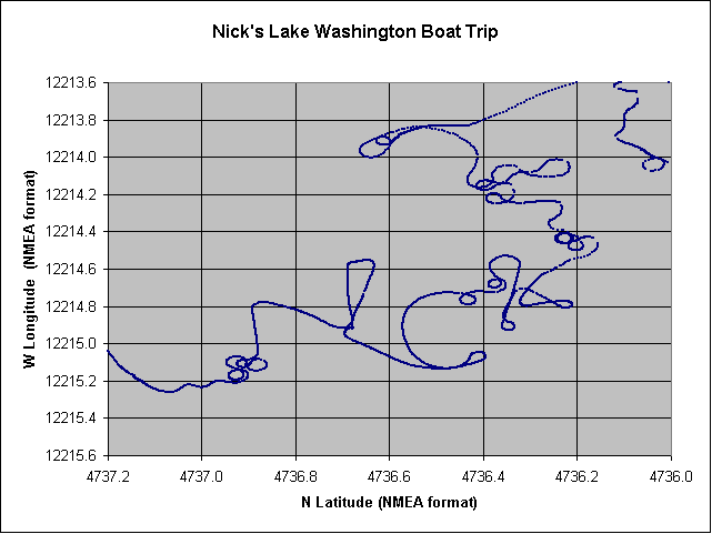
Now we zoom in on the geowritten letters. The "N" is nice; the "I" way too close and off angle; the "C" turned out very well; and the "K" is at least readable. All in all, not bad for a first try:
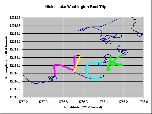
Finally, with Excel and vi, by manually locating the points corresponding to the beginning and end of each letter, and by changing color of each segment, we get the plot that I envisioned. These are $GPGGA NMEA sentences from 22:39:42 UTC to 22:59:46 on 2003-07-30:
Thousands of people enjoy the new sport of GeoCaching; how many of you have tried GeoWriting? Try it: with a boat, or airplane, or even a long car trip. Who can geowrite the largest word, the longest name, the best looking script? If you know of other examples of geowriting please let me know. Here's something similar: GPS Drawing Gallery.
Thanks again to John and Sue for the boat.
Thanks to Lesley for the boat party trip idea and all the work to set it up.
Thanks to Victor and Mike for joining me.
Thanks to Joshua, Casey, Stephen, Austin, Kevin and Tim for joining Nick.
Happy Birthday Nicholas! Love, Dad.
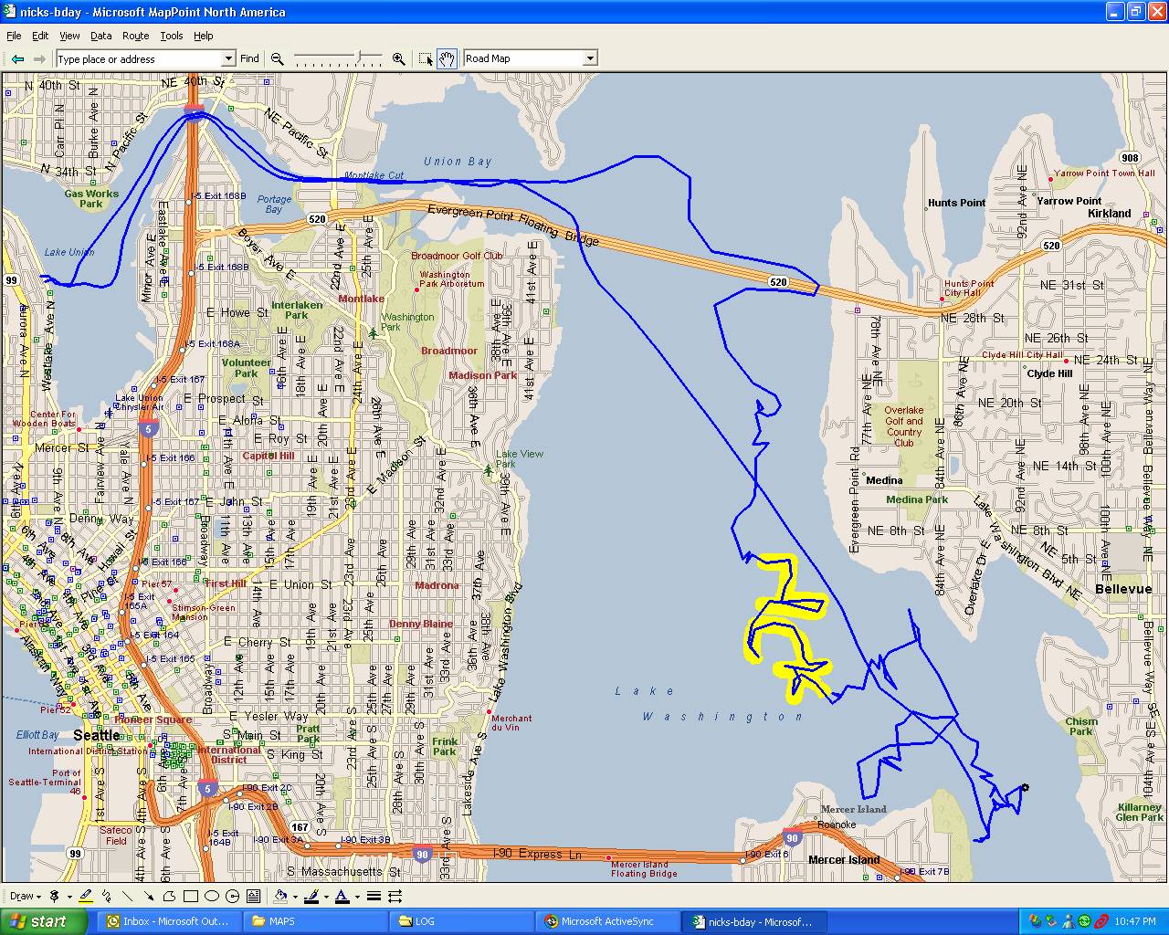
Victor, with his mapping apps, contributes the following map overlay of the trip:
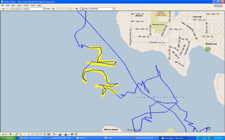
A larger, more detailed, complete trip map is here (306 KB).
The crew (L to R): Joshua, Casey, Mr Victor, Austin, Stephen, Nick, Tim, Mr Tom, Kevin, Mr Mike.